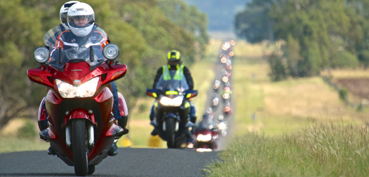
From issue 165, Chris Daly tells the story of the fantastic roads, great scenery and grizzly bears as he rode the USA Northwest to Canada…
Have you even seen how a foreign tourist reacts when they see their first kangaroo? That’s how we looked when we saw our first grizzly bear, a massive, beautiful beast. Except a kangaroo won’t eat you. And Americans think Australia is dangerous just because we have a few snakes and spiders.
Over the years riding in the USA, we had seen a couple of black bears, lots of deer and elk, many buffalo, roadrunners in New Mexico, a bobcat in Texas and a coyote in Death Valley, but this was our first encounter with a grizzly. We were in Glacier National Park in the north-west US state of Montana after riding from San Diego in southern California. Known as the “crown of the continent”, Glacier is located in the north of Montana next to Canada and contains glaciers and glacial lakes plus a bucket-list motorcycle ride called the Going-To-The-Sun-Road.
The route north took us up the eastern side of the Sierra Nevada Mountains in California, across the White Mountains into Nevada, through the south-east corner of Oregon and then into the north-west state of Idaho. Idaho is very scenic, with the majestic Rocky Mountains running through it, and also has some of the best bike roads in the USA. There are lots of twisty tarmac following the courses of rivers in the valleys, and then you wind up and over passes in the mountain ranges of the Rockies.
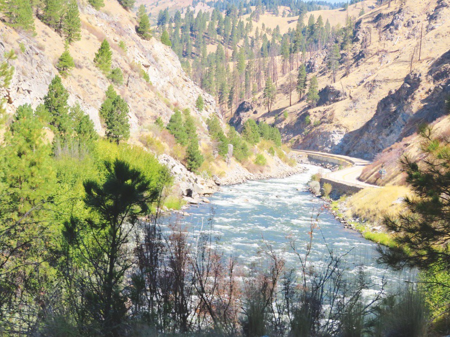
North of Boise we rode Idaho-55, a winding road running next to the Payette River and with constant 50-80km/h bends. After 145km of blissful riding, we reached Payette Lake, which has an Idaho version of the Loch Ness monster called Sharlie. We stopped for lunch on the edge of this high-altitude lake but Sharlie didn’t make an appearance. Then it was back onto the twists and turns of the 55 before turning south on US-95, another good bike road, to the small rural town of Cambridge (population 460) that had one motel, one gas station, one general store and two restaurants, one of which was closed.
HELL’S CANYON
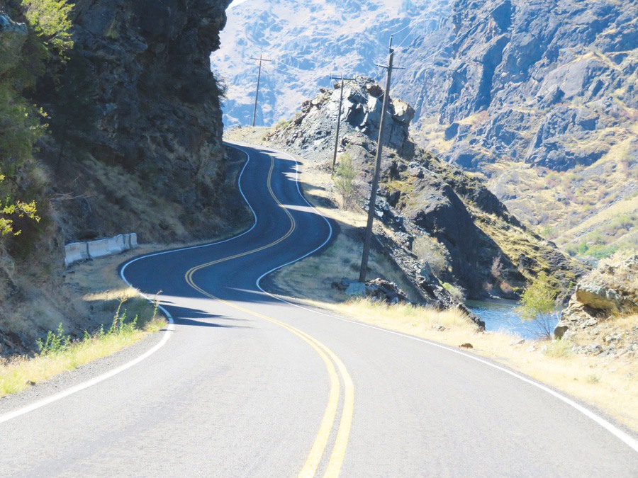
Cambridge was not far from Hells Canyon Road. Any road that has “hell” or “devil” in its name is usually worth riding and this 70km return ride alongside the Snake River to Hells Canyon Dam and back was no exception. The road looked like an asphalt rollercoaster track as it twisted and turned and climbed and fell through corners ranging from 30-55km/h. As we leaned into some corners with no guardrails, we found ourselves peering down steep drop-offs to the river below. I was sure my wife was having a ball on the back because she was screaming a lot over the intercom. At the end of the road, there was a visitor centre where we sat outside taking in the rugged scenery and watched boats heading off down the rapids. At the dam we had a chat with a group of riders, many on Honda ST1300s like us, who had come up from Boise on a day ride. When they asked where we had come from, I replied “Sydney, Australia”. That’s always a good way to get a conversation going when riding in the USA.
SCENIC BYWAYS
Our trek east to Montana was on US-12, called the North West Scenic Byway. This is a popular motorcycle road in Idaho and has lots of good sweepers and not-too-tight corners as it runs alongside the Lochsa River before climbing up into the Bitterroot Mountains. It was good popping the visor up to take in the smell of the pine trees in the chilly morning air as we rode next to heavily forested mountains. We stopped to look at the scenery a couple of times next to the river, where the sound of the rapids was interrupted only by the sound of bikes tearing past. After nearly 200km on this great road, we reached the top of Lolo Pass in the Bitterroots and crossed the state line into Montana.

Montana is a scenic state with the Rocky Mountains in its west and the Great Plains in the east. As we headed north, we could see the 2500m-3200m peaks of Glacier National Park in the distance (Australia’s Mount Kosciuszco is 2228m). Unlike the west side of Glacier, where there are large tourist towns, the scenic east side is much less crowded, with only one town, Browning. Situated in the eastern foothills of the Rockies at the start of the Great Plains, it is a reservation town and headquarters of the Blackfeet Nation, the largest Indian tribe in Montana. With a population of around a thousand, the town gave an impression of untidiness, with no one really caring. We stayed four nights at a motel run by the Blackfeet Nation and used it as our base as it was close to Glacier and also to the Canadian border. We had spent two weeks riding in Canada the year before but had not been able to get into Waterton Lakes National Park, just over the border in Canada, due to fires.
“…a couple of black bears, lots of deer and elk, many buffalo, roadrunners in New Mexico, a bobcat in Texas and a coyote in Death Valley…”
The scenery in Glacier was superb, but we soon noticed signs everywhere warning of the danger of bears. All picnic tables had signs on them and we hoped a bear wouldn’t wander up, attracted by the strange but enticing smell of vegemite on our sandwiches. At Many Glacier we saw a mother black bear and two cubs on a nearby hill looking for berries, and also a large black bear walking along the side of the lake, luckily away from us and not towards us. A ranger told us that black bears will generally stay out of your way, but grizzly bears can be aggressive. We took a boat across the lake at Many Glacier and then walked through the forest with other tourists to another lake for another boat trip. When a show of hands was called for: only a few of us weren’t carrying a can of bear spray. The guide told us not to worry as he reckoned more people were injured by accidental bear spray discharge than by bear attacks. Just to be on the safe side, I checked to see who was carrying bear spray and we stayed close to them…
For the day ride to Waterton, we headed north from Browning through Great Plains country before cutting up into the mountains to an isolated border post at Chief Mountain. In that pre-COVID time, we crossed into Canada with minimal fuss without even getting off the bike. Canadian speed signs are in km/h, a trap for unwary Americans used to mph in the USA, who sometimes think an 80 sign in Canada means 80mph and get done for speeding by the local constabulary.
SCOTLAND, IN CANADA
At Waterton we went to the grand 1920s Prince of Wales Hotel that overlooks the fjord-like glacial lake, where the staff wear kilts and you can take high tea or drink expensive Scottish malt whiskey in the bar. We sat in comfortable chairs in the lobby and drank hot chocolate as we took in the beautiful view over the lake. Unfortunately, smoke from fires in west Glacier had blown north to give the lake and valley a misty appearance. The surface of the lake was like glass and a kayaker paddling on it left a wake of ripples that lasted for ages. We were pleased we had made the effort to finally see this place.

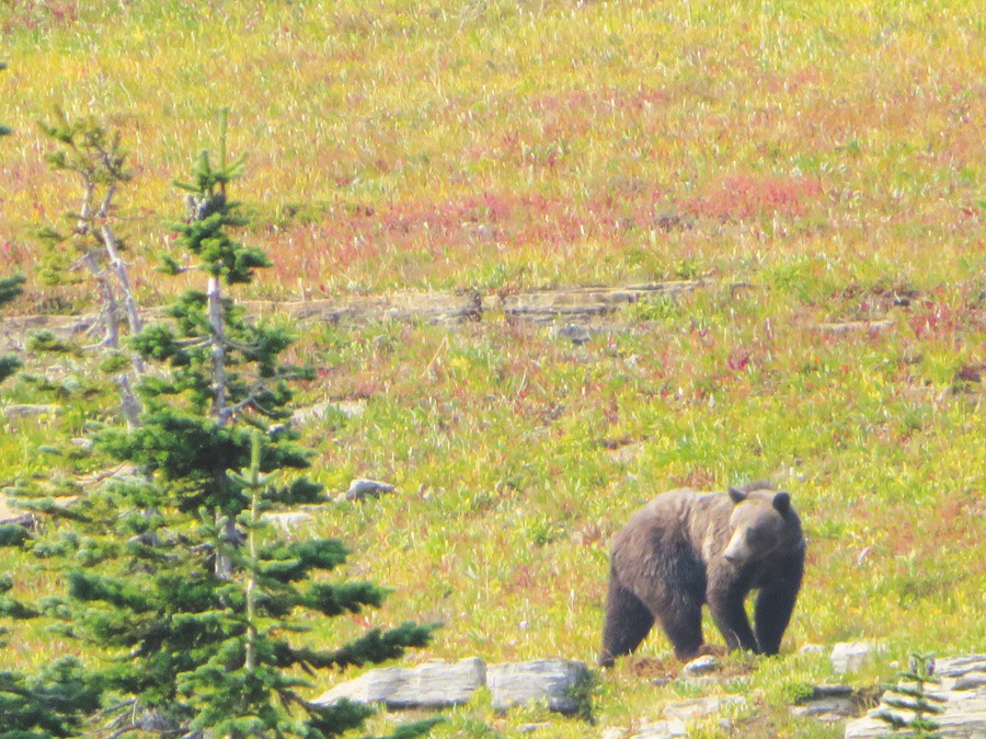
SPOTTING A GRIZZLY
On our last day in Glacier, we rode up the scenic 30km Going-To-The-Sun Road from the park entrance to the top of Logan Pass. It was a great road carved into the side of the steep mountains, but enthusiasm for speed was curtailed when I saw a park ranger with a radar gun on the side of the road. In fact, taking it steadily lets you appreciate the views and also look for wildlife. When we spotted the grizzly, it was walking and foraging across the side of a hill and was about 150m from us. How fast can a grizzly cover 150m? We hoped we wouldn’t find out. We were able to see the hump on the bear’s back that identifies it as a grizzly. Black bears don’t have this hump, although they can be brown in colour like grizzlies. It was a big animal and moved very smoothly over rocks and across the terrain and we were able to keep track of it for about 15 minutes before it headed out of sight. And we had lived to tell the tale.
AMERICAN WILDERNESS
After Glacier, we headed further west into Montana and based ourselves at Libby for a couple of days. From there, we rode a 190km loop around Lake Koocanusa, heading north through rugged country on Montana-228, which had no traffic and corners all the way, and then returning down the eastern side of the lake on a road with many high-speed sweepers. This is wilderness country where hunting is popular — so in restaurants and sporting stores the walls are lined with the stuffed heads and bodies of wildlife. Taxidermists obviously do a good trade. Not far from Libby, we visited a grove of giant western red cedar trees that were over 50m high and some had trunks 3m in diameter. When we set out to walk a loop through the cedars, a hand-written notice at the start dated two days earlier warned that a bear had been sighted near the path.
“Did you bring the bear spray dear?”
“No dear, I thought you had it.”
We survived the walk unmolested by bears.
DESERTED SCENIC BYWAYS

Our route then took us to pretty Coeur d’Alene in northern Idaho before heading back into Montana, where we picked up US-93 and pointed the bike south for our trip home. We followed it over the Lost Trail Pass and swept down the steep, winding road back into Idaho. Stopping in the quaint town of Salmon, Carmen managed to find a quilt shop in a back street. This happens a lot.
Both before and after Salmon, US-93 is called the Salmon River Scenic Byway and is a cracker of a bike road, winding through wild country. In Idaho and Montana, many roads are designated officially as “Scenic Byways”. Their twisty routes and corner cambers are generally so good you could be forgiven for assuming they were built with motorcyclists in mind. After Challis, we continued following the serpentine course of the Salmon River on Idaho-75 on what seemed to be a brand-new road surface. At picturesque Stanley we left the river and turned onto Idaho-21, the Ponderosa Pine Scenic Byway, to climb up and over the Sawtooth Range on another multitude of bends. Riding in Idaho is like doing a self-directed cornering course amid amazing scenery.
“Any road that has “hell” or “devil” in its name is usually worth riding…”
Leaving Idaho, we continued south through eastern Oregon on US-395. This part of Oregon is desolate and at one stage it was 230km between towns. Lake Abert, which stretches for 25km beside the road, has high sodium-carbonate levels, making the salt edges look like white sand. Skirting Reno, Nevada, we were back in California. We crossed the Sierra Nevadas on Ebbetts Pass (2665m high) that we renamed “Terror Pass” as it was narrow and winding, with multiple blind corners and no centre line marking. Luckily, the road surface was excellent and a white stripe on the edge gave me something to focus on when a vehicle came the other way.
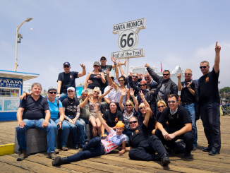
Two days later, we were back in San Diego. When I marked the final route leg on my map, I calculated we had ridden nearly 8000km on our expedition to the American north-west. Put it on your wish list. You won’t be disappointed.
Motorcycle friendly
At an overnight stop in Grangeville, Idaho, the desk manager invited us to park under the covered motel entrance and then put witch’s hats next to our bike and two other bikes to keep cars away. He also put cleaning towels on the bike seats for our use. Looking after motorcyclists like this is common in a lot of motels in the USA.